1940 Buenos Aires from Above
I’ll tell anyone that listens that the best map of Buenos Aires is the Interactive Map on the Buenos Aires City Government site. With it you can easily find any street address and for planning a journey on public transport it’s indispensable.
However, today I discovered a feature I’d not spotted before which makes me very happy indeed (it doesn’t take much). As well as the expected map and satellite views, it offers a choice of photographic overlays from times gone by. A satellite view from 2004 and aerial views from 1978, 1965 and 1940. I’ve spent most of the afternoon exploring 1940s Buenos Aires and am going to sharing some of the highlights here (click on all photos for larger views), most of which we visit in the daily tour.
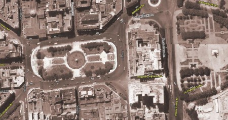
Completed around about the turn of the 20th Century, the Plaza de Mayo has not changed beyond recognition in the 71 years since this photo was taken. The main change is that the Casa Rosada was surrounded by roads on all four sides back then. Balcarce to its left as we look at it is now pedestrianised and the Paseo Colón passed right past the front of the building instead of looping round the gardens as it does now. Also, with fewer trees than nowadays, it’s easier to see the symmetry of the Plaza itself in the aerial view, something its hard to appreciate from ground level.
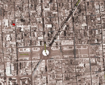
If the Plaza de Mayo hasn’t changed much, then the above shot shows an area that has undergone some major work. We all know the Avenida 9 de Julio these days as it cuts its way through the heart of the city. Well it hasn’t always been this way – back in 1940 it was only 5 blocks long and was more of a Plaza than an Avenida! The Obelisco had been built 4 or 5 years prior and it wouldn’t be for another 10 years until the buildings between Cerrito & Carlos Pelligrini would be levelled to extend the avenue. The Teatro Colón can be seen in the bottom left of the picture.
El Caminito, now one of the main tourist attractions in Buenos Aires was a long way from that in 1940. As the above picture shows it was then simply a spur of the main railway that served the docks. It wouldn’t be for another 15 years before local artist Benito Quinquela Martín would begin working on his vision of transforming it into Buenos Aires’ first open-air musuem.
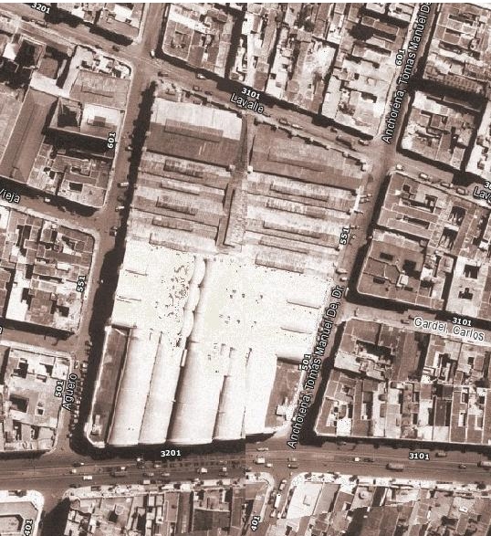
The above picture shows one of the main sights of the tour, the market building in Abasto. At the time of this picture it had only been open for 5 years and would remain so for another 44 years. Clearly visible is the rear sections which is somewhat altered these days, but the front section remains intact as it was then. Also note the tramlines running up and down Corrientes. Buenos Aires once had one of the largest tram systems in the world (more than 850km of track at its peak) which was dismantled in the 1960s in favour of buses.
There is, of course, much more to be discovered with these wonderful old aerial shots and as I find more things of interest I’ll post them here.


Hi there!
I was so excited to see your post about the interactive map!!! Could I talk to you more about the history of Buenos Aires? I’m, specifically, looking to research 1945 from a tourist’s perspective – what was new back then, what was hot, what of that remains today.
Ashley